Permitting and licensing software, built for you
Camino's software is changing the way governments do work and engage with citizens. Our system can be configured to meet your needs - mix and match features to create simple-to-use solutions for many use cases.
Get started with Camino


... Plus so much more.

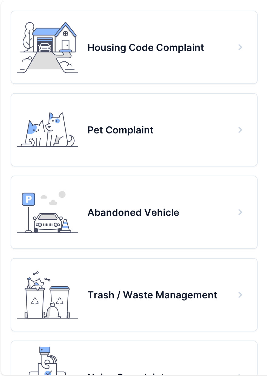
Intelligent Applicant Portal
Camino’s application portal looks and feels like all the cutting-edge software your customers love. Use our Development Guide and GIS engine to help applicants through the process and ensure accuracy.
We offer a 100% online, simple experience for information gathering, payments, change requests, inspection scheduling, document issuance and more.
“The web portal improved our ability to better serve our customers. It made the process of obtaining a non-retail license clearer, the ability to understand what could be permitted on a parcel more transparent and the submission of an application more streamlined.”
— Santa Cruz County, CA
See the Customer Story →Ensure Accuracy and Consistency
With Camino you never need to worry about whether your process is being followed correctly. We have automation infused throughout the software to make sure the right steps happen in the right order.

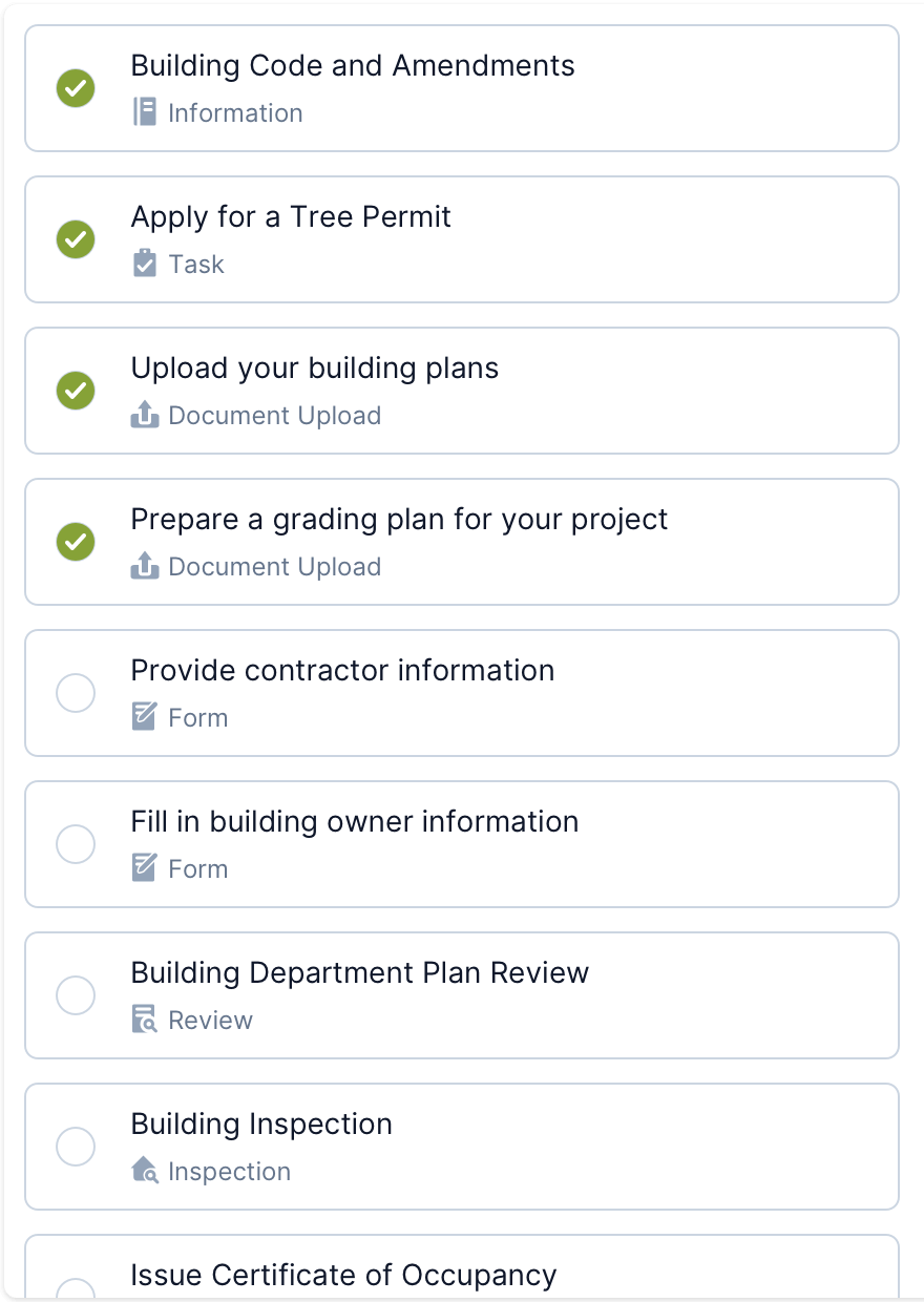
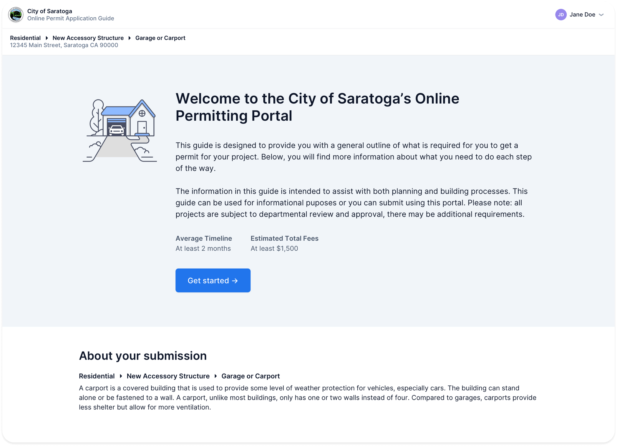
Smart Application Checklist
Using Camino’s GIS-powered Development Guide, you can ensure that every applicant knows exactly which documents and forms to submit with their application. It’s all presented through an approachable checklist.

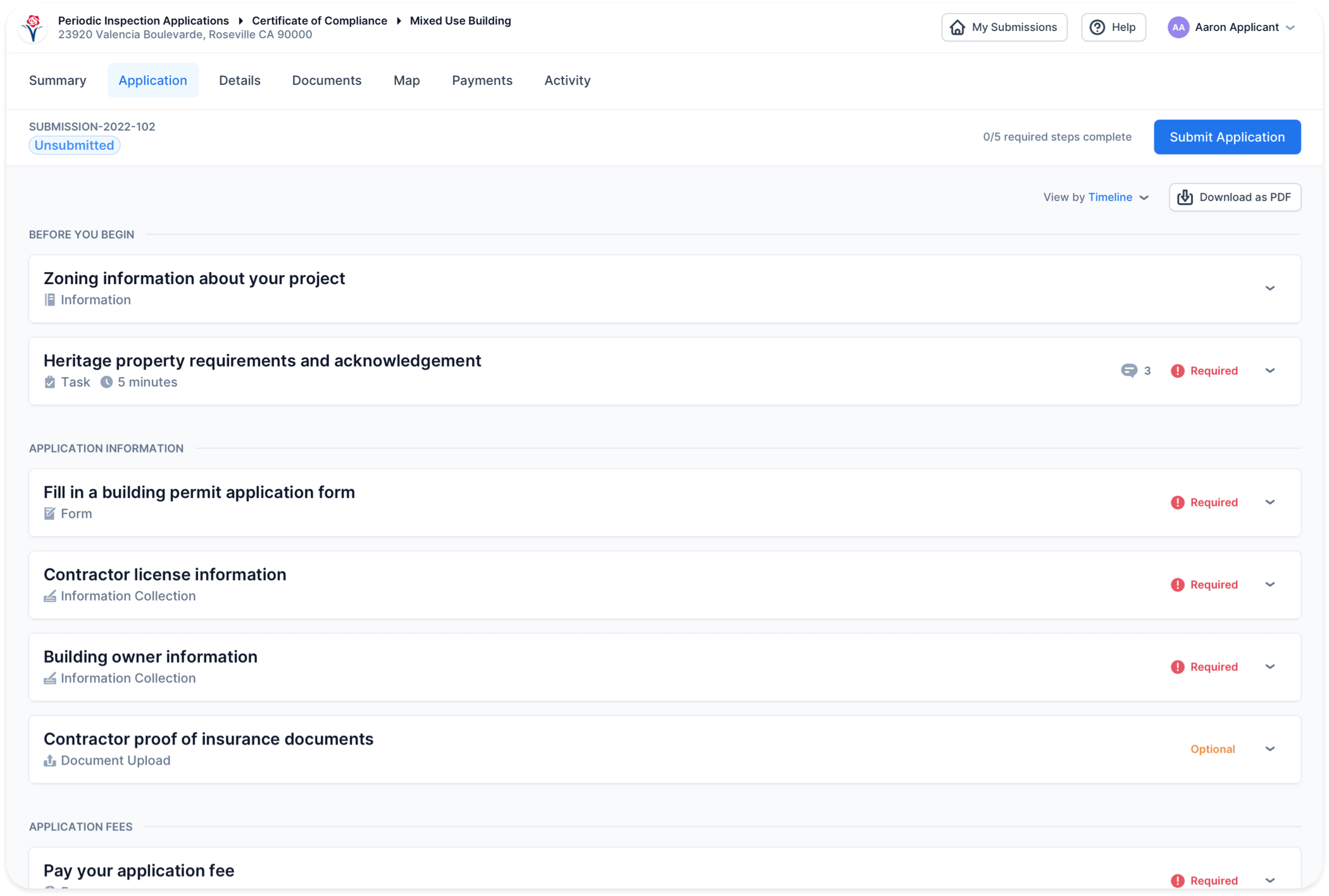
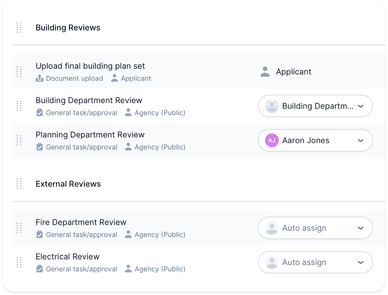
Dynamic Workflow
Each application type can be configured with a tailored workflow that makes sure every correct step is followed. And our workflows are dynamic, meaning it’s easy to add or remove requirements as project details change.
Keep Everyone Up to Date
When there are a lot of moving pieces to a project, it’s important to keep people in the loop. Camino has thoughtful notifications built in to the system to make sure you and your applicants never miss an update.

Automatic Notifications
Every time an application is submitted or updated, we’ll send a notification to the applicant and any staff involved. You can choose who gets the notifications and when.

Automatic Assignment
Set up auto-assignment rules for review staff and inspectors. They’ll automatically be notified and have a task assigned when a project reaches the right stage.
Communicate In One Place
Relying on email and phone calls means that a lot of important informations doesn’t get logged in your system.
Built-In Messaging
We’ve built in a messaging system that lets you communicate directly with applicants without leaving Camino. All the history is preserved.
Message Templates
Sending the same messages over and over? Save your common templates in Camino and easily pull them into messaging whenever needed.
Seamless Collaboration
Camino has project management tools built in, so your team can easily get work done. Assign tasks, modify workflows on the fly, and more.
Task Management
Assign and complete internal tasks to manage your daily workflow.
Projects
Group multiple Submissions into projects to organize work for your team.

"Camino is one of the best software applications I have used. The staff are extremely responsive, helpful and work hard to meet our ever changing needs. I would highly recommend it to any company or City looking to jump into the digital application world for the first time."
— Alameda, CA

“Prior to Camino, our permitting system had very little value-add to benefit the public, whereas Camino's primary benefit is to the public. We are providing better customer service without expending staff time.”
— City of Saratoga, CA
Manage Your Field Work
Camino comes with lots of features to help you manage inspections, from scheduling to recording results in the field.

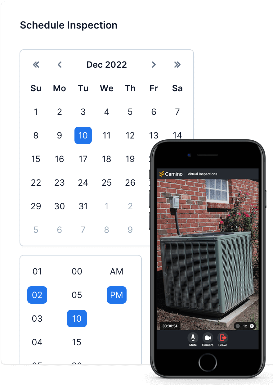
Easy Scheduling
If you want, let your applicants request or schedule inspections online. Your inspectors have ultimate control of their calendar and can make adjustments as needed.

Video Inspections
Don’t want to drive all the way out to a site? Camino has virtual inspections built right into the platform - just click a button and start a live video session right away.
Learn more about Virtual Inspections →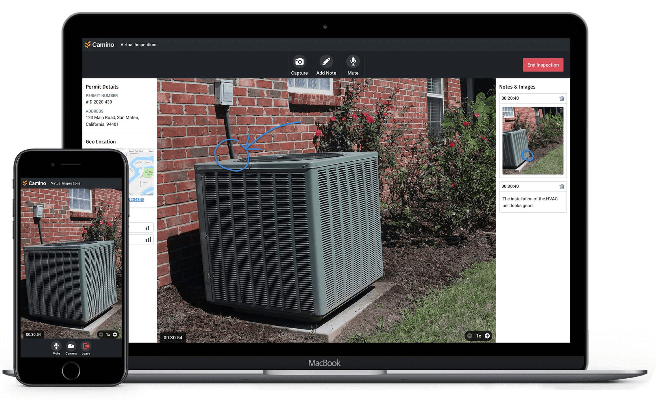
Reporting, Across the Board
We make it easy to find the information you need within Camino in seconds. And if you need more functionality, you can always plug in your favorite reporting engine.

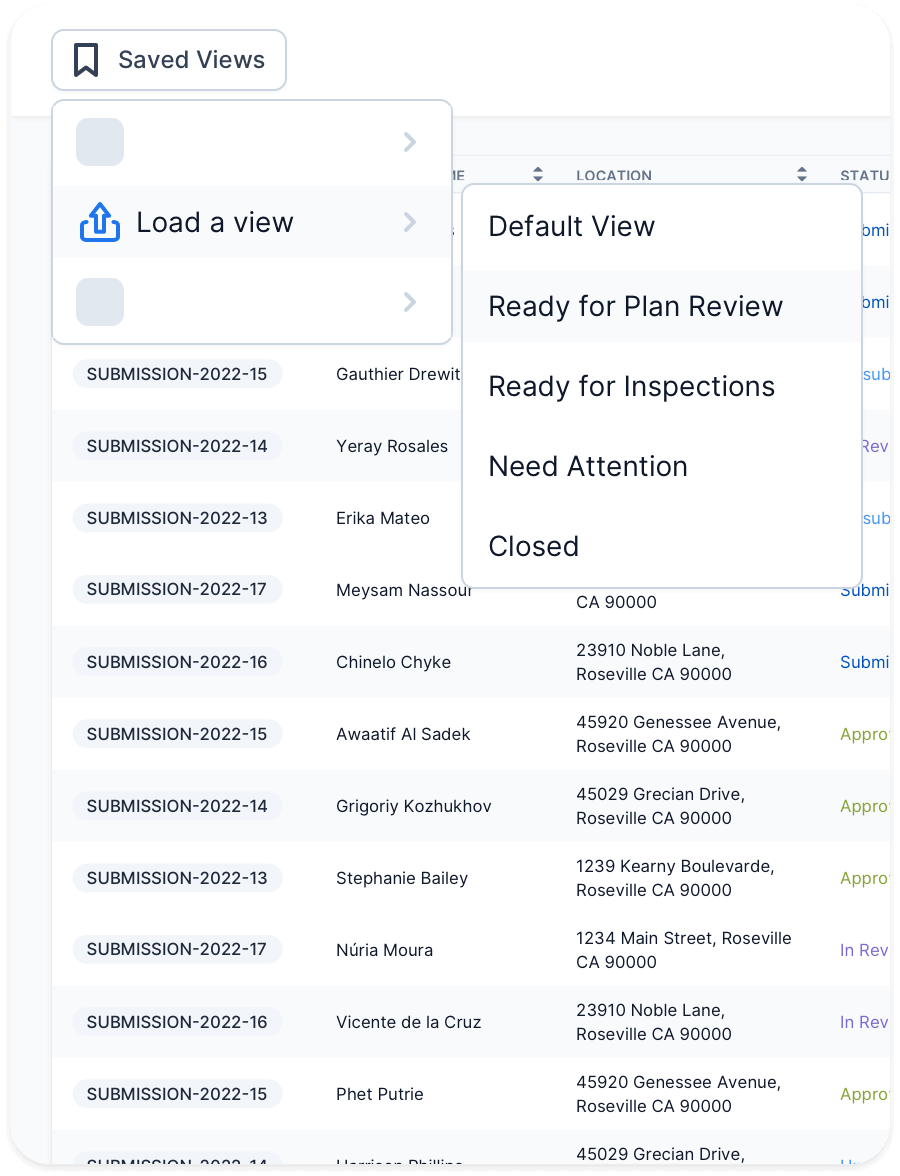
Custom Views
Easily search or filter submission data by any field in the system, then create saved views that you need to come back to frequently.

Activity Feed
Coming into a project late and need to get up to speed? Every submission in Camino keeps a detailed, running log of every message, update, and milestone. You’ll know exactly who did what, when.

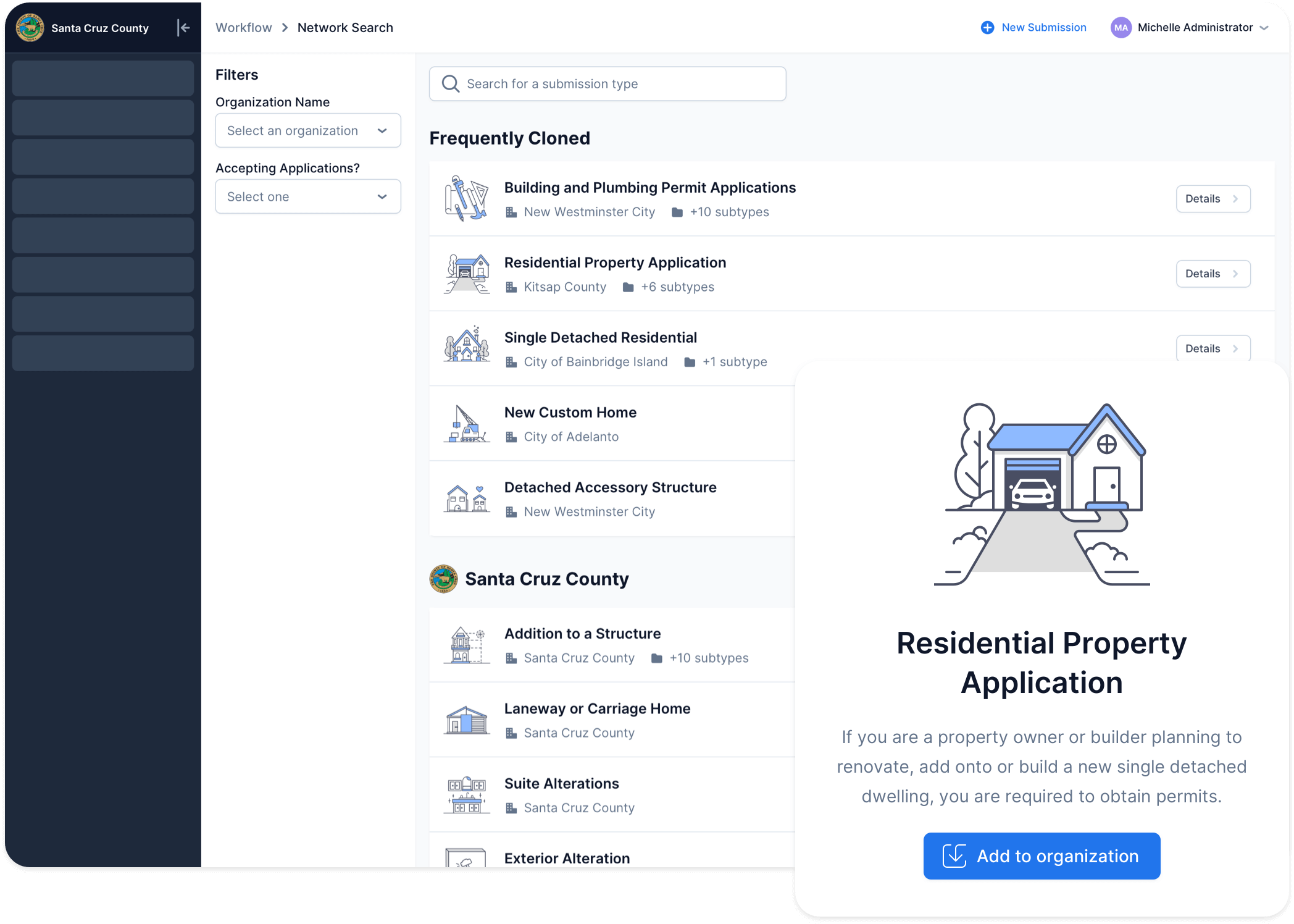
Industry-First Network Search
Find inspiration and processes from other agencies that use Camino. Copy entire workflows over with one-click and then tailor them to your needs. You can easily shave weeks off of your implementation.
Surprisingly Easy to Implement
Setting up a new permitting or licensing system can be daunting. We’ve made a ton of investments to ensure you have a smooth and stress-free process.

All configuration is done through a visual, no-code interface that's quick to learn. Our users frequently build and launch their own Guides in a matter of days.

Using our Network Search library, you can bring in content and rules from other agencies around the country. No need to redo work that somebody else has already done!

Our experienced implementation team is there to assist you the entire way. Our customers love how supported and guided they feel through the entire process.
Integrate Quickly
Camino offers a robust API that makes it easy to connect with your other important systems.
GIS

Plan Review


Payments


+ more
Documents

Reporting


“Honestly, it was a lot of fun. I am the lead staff person for Camino in our office, and I was able to customize and build out our processes in Camino without frustration due to the ease-of-use that the back end of the software provides.”
— City of McKinney, TX
See the Customer Story →Uncover Development Trends
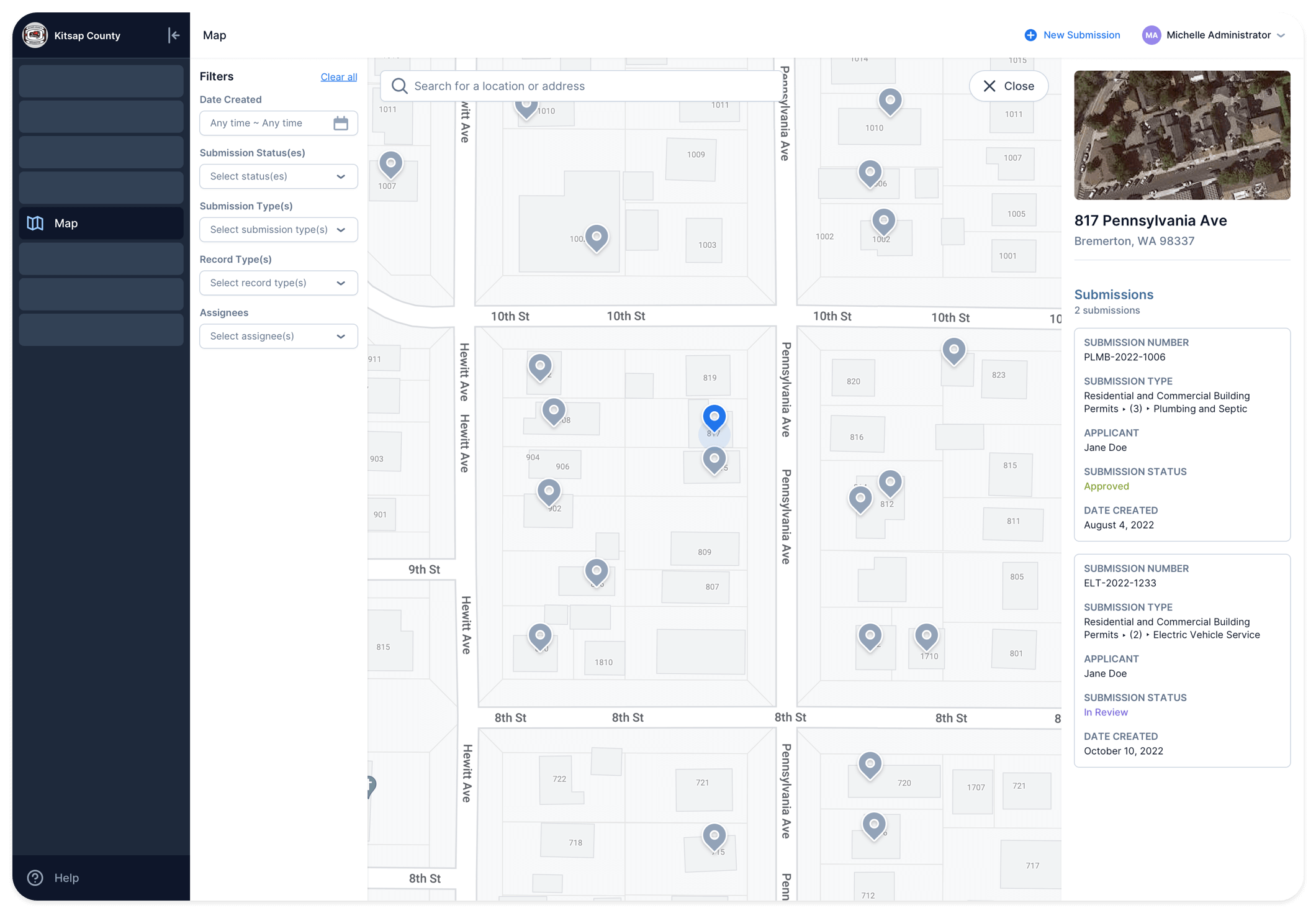
Because all Camino software incorporates our Development Guide, you can set up an online portal for applicants to do research months before they ever apply for their project.
We make that data available to you through a powerful map report that will let you spot future and current development trends. Stay ahead of growing workloads and share reports with leadership.

Priced to be Used
Our pricing is simple and transparent and encourages you to get maximum value from our software. No seat licenses, usage-based pricing, or limits on data. For smaller agencies our subscriptions start at just $10,000 per year.
Much More Under the Hood
Guided Application Process
Automatically provide every applicant a list of the forms, fees, and documents that are required for their project.

Online Portal
Once an application is submitted, applicants can track their project status in real-time through our online portal.

Virtual Inspections
Take Camino with you in the field. Access project information and log inspection results through your phone or tablet.

Document Uploads
Applicants and agency staff can upload required plans or documents directly to Camino.

GIS Triggers
Detect whether a project is allowed by the zone. Flag requirements for flood zones, fire zones, and historical preservation areas.
Automatic Fee Calculations
Based on project details, calculate the costs for simple and complex, multi-permit projects.

In-App Comments
Respond to applicant’s questions directly through Camino. Capture all communication in one place.
Notifications
Camino intelligently notifies internal users and applicants when there are updates to their project.
Activity Feed
Quickly see a snapshot of all activity across a project in one central place.

Message Templates
Save your common templates in Camino and easily pull them into messaging whenever needed.
Dynamic Workflows
Our workflows are dynamic, meaning it’s easy to add or remove requirements as project details change.

Renewal Management
Automatically notify applicants once they are ready to renew and accept renewal applications through our online portal.

Document Issuance
Create your own custom digital templates and issue documents to the applicant at any point in your workflow.

Map Reports
Our map tool allows you to spot future and current development trends and stay ahead of growing workloads.

Developer API
Camino offers a robust API that makes it easy to connect with your other important systems.
Automatic Assignment
Review staff and inspectors can automatically be notified and have a task assigned when a project reaches the right stage.
Scheduling
Let your applicants request or schedule inspections online. Your inspectors can make adjustments as needed.

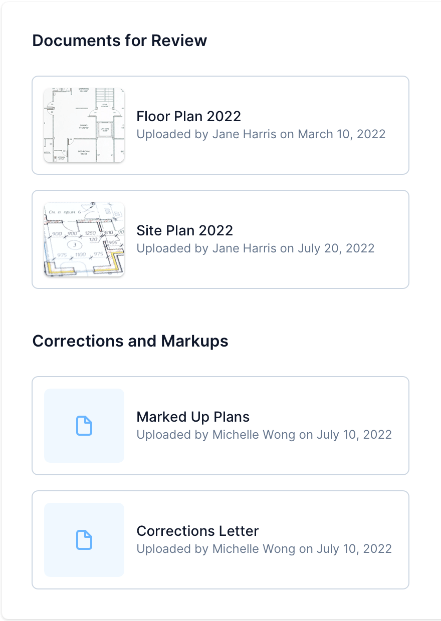
Plan Review
Conduct digital plan review in Camino and track multiple review cycles. Works with or without an integration.

Santa Cruz County Automates Cannabis Licensing and Decreases Processing Time by 75%
“The web portal improved our ability to better serve our customers. It made the process of obtaining a non-retail license clearer, the ability to understand what could be permitted on a parcel more transparent and the submission of an application more streamlined.”
— Melodye Serino, Deputy County Administrative Officer
See the Customer Story →

In times of significant staffing shortages, Camino saved our operations
“Without a collaborative partner like Camino, it would have been nearly impossible to effectively deploy a new permitting and business licensing system in the height of the pandemic and the City of Syracuse would not have been able to meet the needs of its residents and businesses.”
— Mediha Salkic, Central Permit Office Director
See the Customer Story →